3D Massing
Exploring new ways to share information with each other is a cornerstone of improving the planning process. To do this it is essential to have city-wide data in accessible formats. A variety of 3D digital information and models exist but currently the data is not readily available to the general public. Providing a consistent city-wide 3D data source will link these digital city planning models and materials together and will allow us to imagine our city from different perspectives. The Open Data site will enable access to application developers, designers, urban planners and architects, and the public. Ideally this will enable the creation of a visual portal and access to a large collection of city building ideas.
Further to the Open Government Licence, the Context Massing Model is being provided by City Planning on the Open Data website for information and illustrative purposes only. City Planning does not warranty the completeness, accuracy, content, or fitness for any precision purpose or use of context massing model for such purposes, nor are any such warranties to be implied or inferred with respect to Context Massing Model as furnished on the website.
City Planning and the City are not liable for any deficiencies in the completeness, accuracy, content, or fitness for any particular purpose or use of Context Massing Model, or applications utilizing Context Massing Model, provided by any third party.
Context Massing Model MUST BE VERIFIED BY THE USER FOR LEGAL OR OFFICIAL USE.
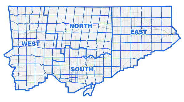
Please use this Interactive Map to locate the 3D Massing tiles for SketchUp and AutoCAD format
For further information visit the Urban Design web site
A note on property assessments:
MPAC (Municipal Property Assessment Corporation) holds copyright on many aspects of data around properties. The City of Toronto is unable to provide this data. From the MPAC website:
MPAC 's range of services includes:
-
- Preparing annual Assessment Rolls for use by municipalities and the Province to calculate property and education taxes.
Assessment Maps and Ontario Parcel (TM)
In 2005, MPAC, the Ontario Government and Teranet Enterprises Inc. completed the Ontario Parcel(TM) - an ambitious project that brings assessment, ownership and land parcel data for almost 4.6 million properties into a standardized digital database. ...
The Ontario Parcel(TM) is available to Ontario municipalities, public organizations and private businesses. Among other things, the Ontario Parcel(TM) data can be applied to property assessment and taxation, land registration, land use planning, land management and business planning.
With the implementation of the Ontario Parcel (TM) and the digital mapping environment, MPAC no longer produces paper assessment maps.
If you would like more information about the products and services available under the Ontario Parcel (TM), please visit the Ontario Parcel (TM) website at www.ontarioparcel.ca.
You will need to contact MPAC directly for data that you may perceive as missing. MPAC website.
Data and Resources
-
Tile Locator Reference File (PDF)PDF
-
Interactive Map Tile Locator (AutoCAD, SKP)WEB
-
3DMassingShapefile_2016_WGS84.zipSHP
-
3DMassingShapefile_2017_WGS84.zipSHP
-
3DMassingMultipatch_2017_WGS84.zipSHP
-
3DMassingShapefile_2018_WGS84.zipSHP
-
3DMassingMultipatch_2018_WGS84.zipSHP
-
3DMassingShapefile_2019_WGS84.zipSHP
-
3DMassingMultipatch_2019_WGS84.zipSHP
-
3DMassingShapefile_2020_WGS84.zipSHP
-
3DMassingMultipatch_2020_WGS84.zipSHP
-
3DMassingShapefile_2021_WGS84.zipSHP
-
3DMassingMultipatch_2021_WGS84.zipSHP
-
3DMassingShapefile_2022_WGS84.zipSHP
-
3DMassingMultipatch_2022_WGS84.zipSHP
-
3DMassingShapefile_2023_WGS84.zipSHP
-
3DMassingMultipatch_2023_WGS84.zipSHP
-
3DMassingShapefile_2025_WGS84.zipSHP
-
3DMassingMultipatch_2025_WGS84.zipSHP
Additional Info
| Field | Value |
|---|---|
| Dataset Category | Document |
| Refresh Rate | Annually |
| Collection Method | |
| Excerpt | This is a geospatial 3D ESRI shape / 3D CAD format file of building shapes for City of Toronto |
| Limitations | |
| Owner Division | City Planning |
| Owner Section | |
| Owner Unit | |
| Owner Email | Dulini.Ratnayake@toronto.ca |
| Author Email | Dulini.Ratnayake@toronto.ca |
| Maintainer Email | Dulini.Ratnayake@toronto.ca |
| Author | Dulini.Ratnayake@toronto.ca |
| Civic Issues | |
| Formats |
|
| Topics | Locations and mapping |
| Source | |
| Information URL | https://www.toronto.ca/city-government/planning-development/planning-studies-initiatives/ |
| Image URL | |
| Last Updated | 2025-12-05 13:38:35 |
| Is Retired? | False |
| Date Published | 2015-01-05 00:00:00 |